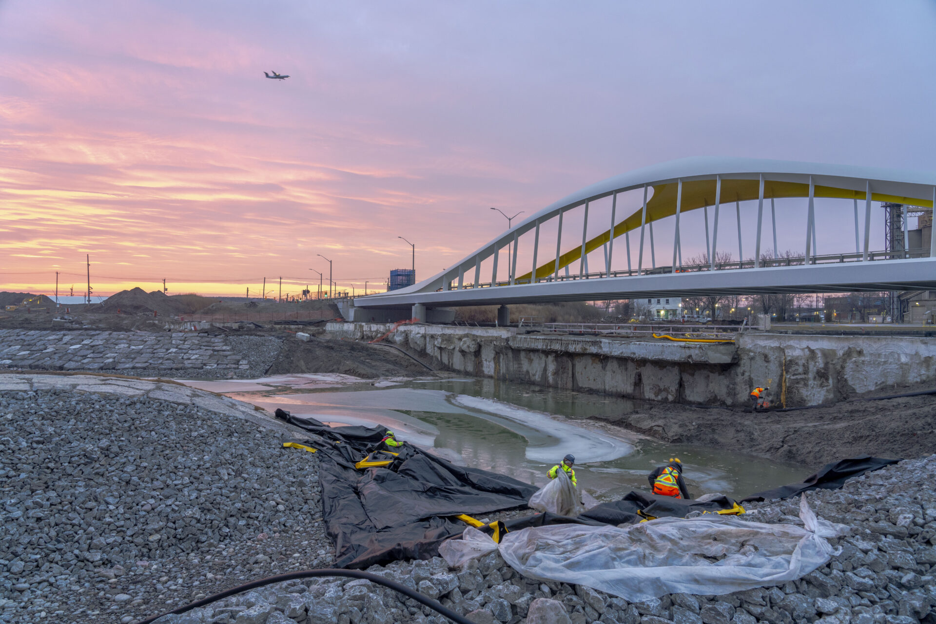

Waterfront Toronto announced a significant milestone in the Port Lands Flood Protection (PLFP) project: the successful removal of the “west plug,” a concrete wall that was separating the new mouth of the Don River from Lake Ontario. This achievement marks a crucial step towards revitalizing and protecting Toronto’s waterfront.
With tri-government support, Waterfront Toronto is unlocking opportunities to create better access to the water, build a more resilient city, and address the city’s urgent need for new housing.
“The Port Lands flood protection project is one of the largest civil engineering projects currently underway in North America. In Toronto, it’s unlike anything attempted before. Despite global challenges, we have stayed the course, keeping us on track to open the new parks and river in 2025. Today’s latest milestone brings us one step closer to reconnecting the new river to the lake,” said George Zegarac, president & CEO, Waterfront Toronto.
Flood Protection and Urban Development: The $1.35-billion Port Lands Flood Protection project protects parts of Toronto’s Port Lands and the eastern waterfront from flooding. This area, equivalent to the size of downtown Toronto, is poised for transformation into new mixed-use communities, global destinations, and more water access for locals and visitors. As part of the design for flood protection, Waterfront Toronto has constructed a kilometre-long extension of the Don River.
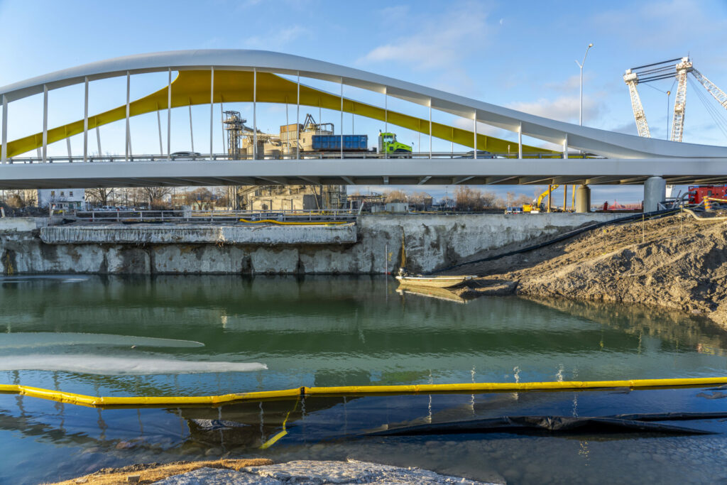
Significance of the West Plug Removal: The West Plug, located at the mouth of the Don River under the Cherry Street South bridge, has been separating the new river from Lake Ontario. Its removal is the first step in allowing the renaturalized Don River to flow freely into Lake Ontario, representing a significant environmental and engineering accomplishment.
Environmental and Community Benefits: The river enables the creation of a new island that will provide an opportunity to build more housing. The renaturalized mouth of the Don River will also provide 25 hectares of publicly accessible green space, plus new wetlands and wildlife habitats, contributing to the city’s ecological diversity and resilience against climate change.
“Today’s achievement is a major engineering feat. By renaturalizing the mouth of the Don River, the Port Lands Flood Protection project is setting the stage for what will be the biggest transformation to the Toronto waterfront,” said Julie Dabrusin, Parliamentary Secretary to the Minister of Natural Resources and Parliamentary Secretary to the Minister of Environment and Climate Change and Member of Parliament for Toronto-Danforth.
The Port Lands Flood Protection project is creating a renaturalized mouth for the Don River, new roads and bridges, cycling connections and greenspace, as well as new infrastructure to support future urban growth. The project is funded by the governments of Canada, Ontario, and the City of Toronto. Construction began in 2018 and the new parks and river will be open in 2025.
“Today’s event brings us another step closer to revitalizing Toronto’s waterfront, laying the groundwork for vibrant mixed-use communities with more housing, recreation, parks and greenspace. Thanks to our government’s significant flood protection investment of over $400 million, we are building the critical infrastructure needed to support growth and ensure safety across Toronto’s waterfront today and for generations to come,” said Amarjot Sandhu, Parliamentary Assistant to Ontario’s Minister of Infrastructure.
Following the removal of the West Plug, the next step is to remove the North Plug at the Keating Channel, further connecting the Don River to Lake Ontario. Construction will also continue on new parks. The new parks and river valley are slated to open in 2025.
In the longer term, a new island community will emerge, built on the foundations created by Port Lands Flood Protection, helping downtown Toronto to grow sustainably, and addressing a growing housing need in the city. This island, temporarily called “Villiers Island,” will have new cycling and walking trails and dedicated space for transit, community amenities like a library and school, local parks and the city’s only urban river walk along the Keating Channel. It will also be home to the Lassonde Art Trail, a free outdoor museum. As the island develops once flood protection is in place, new attractions will make this a landmark waterfront destination.
Featured image: The west plug, visible before the Don River was flooded. (Waterfront Toronto)