By Andrew Snook
Ontario is constantly growing. And as Canada’s most populated province swells in population, additional infrastructure is needed—new schools, hospitals, roads, wastewater systems, the list goes on and on. Every time a new infrastructure project is announced, there are many stages before shovels hit the ground. An important stage in this process is an archaeological assessment. But what exactly does that entail?
To learn more about the archaeological assessment process, Renew Canada reached out to Archaeological Services Inc. (ASI), an Ontario-based consulting services company specializing in cultural heritage conservation, planning and management for the past 40 years.
“It’s one of the requirements for our clients as part of the Environmental Assessment Act, to do the archaeology and cultural heritage assessments,” explains Lisa Merritt, partner at ASI and director of the Environmental Assessment Division.
Consultant archaeologists working on these assessments must follow a set of standards and guidelines that is regulated by the Ministry of Citizenship and Multiculturalism.
“They regulate our licenses. I’m a professional archeologist, and I have a license under the Ontario Heritage Act, which is our overarching piece of legislation that regulates archeology in the province, and the Standards and Guidelines for Consultant Archeologists set out under the Ontario Heritage Act regulate and standardize our work, and tell us what our requirements are,” Merritt explains.
A four-stage process
Archaeological assessments for infrastructure projects follow a four-stage process. The first stage begins with background research and property inspections. Stage 1 is about evaluating the archeological potential of a project. Because Merritt’s team focuses specifically on infrastructure projects, many of their assessments never go beyond the initial stage.
When assessing a property, ASI will inspect the property firsthand, as well as going through historical records and as-builts drawings.
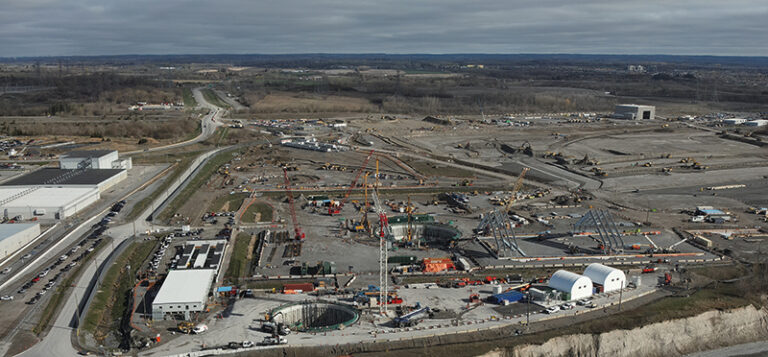
“A lot of the time our work doesn’t go past a Stage 1, because when we’re working on infrastructure, it’s often in already highly disturbed contexts. It’s either been previously assessed or it is an upgrade or change to existing facilities that have already removed any archaeology that may have been there. It’s in a rail corridor or an existing water sewage treatment plant, an existing hydro corridor or an existing road,” Merritt explains.
However, if the initial research does show potential, then Merritt’s team will proceed to Stage 2. This stage involves in-field, hand excavation of resources. One example of an infrastructure project where this can occur is a road widening.
“If they’re widening, sometimes there will be strips of land on either side that will have potential,” Merritt explains. “Road widenings are very common projects that we work on where we find archeological sites, because often these roads were based on narrower historical roads, and then as they widen, they start to impact historical sites that were located along the frontages.”
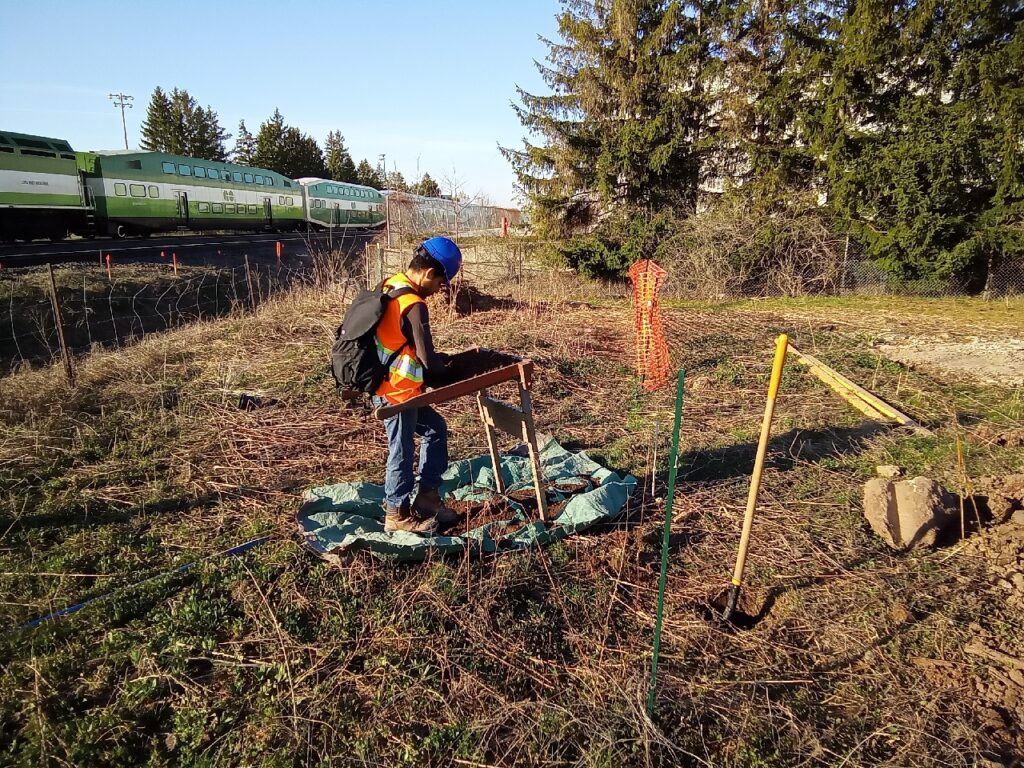
If the land on either side of the road widening project could potentially be undisturbed, the archaeologists will perform a test survey to see if they can find any original soils that may incorporate archaeological deposits that haven’t been impacted.
“If it has potential, and it’s a farm field or just an abandoned lot, we do a test pit survey. We have crews out there that dig test pits at five-metre intervals that are a minimum of 30 centimetres wide and 30 centimetres deep, and they screen the soil, looking for artifacts. That’s how we find our sites,” Merritt explains.
Alternatively, some infrastructure projects are wide enough that if they’re in agricultural fields, archaeologists can perform a pedestrian survey, where they get the field ploughed and then walk on the surface, looking for artifacts at a minimum of five-metre intervals.
“We’ll find any number of artifacts – Indigenous and or historical artifacts – on the surface, and then we instantly stop, and we assess it and determine if it’s a site or not,” Merritt says.
Based on the findings, the archaeologists will then decide whether it needs to go to Stage 3 or Stage 4.
At Stage 3, archaeologists begin to determine what type of site has been discovered, the limits of the site, and the nature of the site—who lived here, if it was an Indigenous site, Euro-Canadian settler farmstead, industrial site, etc.
“We do a Stage 3 to determine whether it needs a Stage 4, which is often a full-scale excavation,” Merritt explains, although protection and avoidance through project redesign is the preferred option, when it is possible.
Even in a highly populated area with a great deal of disturbed land such as the Greater Toronto Area (GTA), archaeological assessments can still reach Stage 4.
“We have dozens of Stage 3s and 4s going on currently [across Ontario], on all range of sites,” Merritt says. “The GTA skews more to the historical, Euro-Canadian settler type sites.”
She says finding Indigenous sites is a much rarer occurrence in densely developed areas like the GTA.
“Indigenous sites are a lot more fragile. Indigenous people lived lightly on the landscape. Their sites typically are in the the top 30 centimeters of soil, and so, can be very easily impacted by hundreds of years of urban settlement and urban growth. People living and building roads and building subdivisions and things in Toronto, for example. So, we don’t find as many in these contexts.”
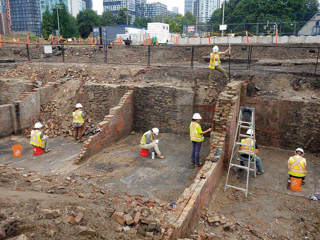
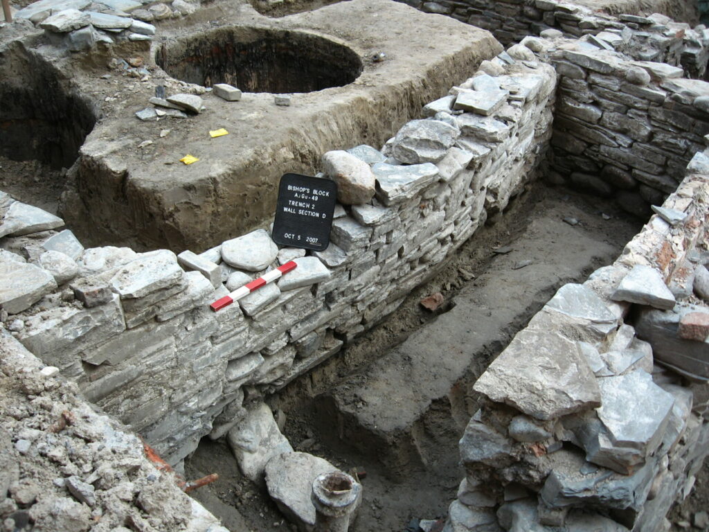
When an assessment reaches Stage 4, full crews are deployed to the sites, which are blocked off and excavated.
“We fully take out the site from the soil, and systematically, we bring the artifacts back, catalog them, and analyze them. We produce very robust reports that then get reviewed by the Ministry and our clients, and ultimately, if the site is unique enough, or if there’s enough interest in it, we try to do as much as we can to disseminate our results through papers and journals, or sharing our research with Indigenous communities, museums or other institutions that are interested in heritage,” Merritt says. “It is also important to inform the general public of the heritage and history of the places we all live in.”
Assessment challenges
While ASI has been providing archaeological assessments for close to half a century, there are still some very challenging aspects to performing these services.
“We’ve done this for 40 years, so we know how to do the work. It’s not the work that’s the difficult part. It’s often working under timelines for infrastructure projects that tend to be quite aggressive,” Merritt says. “We can often be put in the position where we risk holding up the projects, or are blamed for delaying work.”
Finding consensus with Indigenous partners can also be part of the joy and the challenge of projects, Merritt adds.
“We come to it with a western scientific mindset of ‘This is what we found. This is what it means.’ And then we’re learning to reconcile that with an Indigenous perspective, which is often different than how we were trained and learning how to create value with the two working together, looking at it with different lenses and involving Indigenous people in our projects on a hands-on, day-to-day basis, finding and developing those relationships and trust,” Merritt says. “That’s a big part of our job, and a big part of the challenge… when it works, it works beautifully, having indigenous people on our projects that can provide traditional perspectives. It’s so valuable for our teams.”
Archaeological database
To assist with future infrastructure projects, ASI has worked with the City of Toronto on its archeological management plan, which is a database accessible to the public.
“I believe the public can access the Toronto archeological management plans online. There are known very important Indigenous sites in the City of Toronto and other jurisdictions as well, and they’re usually flagged in advance of any kind of a project as archeologically sensitive areas, to avoid impacts,” Merritt says.
While this database is a useful tool, it cannot predict the sensitivity of sites with 100 per cent success.
“It’s not always a sure thing, all the stuff is buried. So, it’s often quite difficult to predict,” Merritt says. We do our best with modeling based on location, proximity to water, and known sites. We have an archeological potential model that has a suite of traits that we do go through as an exercise to determine what the risk is for sites being found in these areas.”
Assessment advice
The key to having archeological assessments run smoothly is to make sure to have all necessary parties involved in the process as quickly as possible, including any Indigenous parties. Merritt says developing positive Indigenous relationships early on in projects makes them go much smoother. She adds that early hiring of firms with a specialty in infrastructure is also a key component and that strong documentation of work that has happened in the past is also important.
“The past has shaped the present and affects the future,” Merritt says.
Andrew Snook is a freelance business-to-business writer based in Mississauga, Ont.
[This article appeared in the September/October 2024 issue of ReNew Canada.]
Featured image: To prepare for major construction on the Ontario Line subway station at Moss Park, Metrolinx enlisted the help of archaeologists to unearth the old foundation beneath the park, where they discovered remnants of nineteenth-century row buildings along Queen Street East. (Metrolinx)

