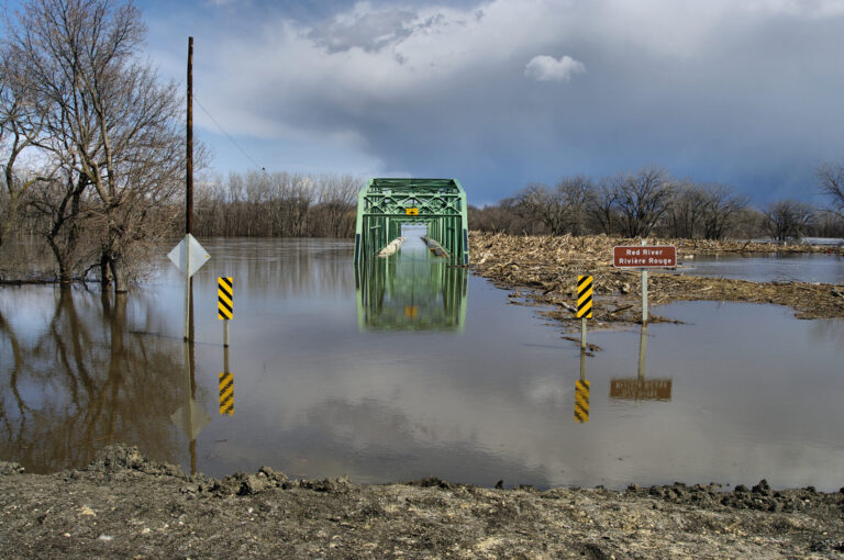

In August 2005, Southern Ontario experienced one of the largest storms it had since Hurricane Hazel. More than 150 millimeters of rainfall in a two-hour period—it was in excess of a one-in-a-100-years storm. Large areas were flooded and many houses experienced sewer backup and many roads were impassable. Most areas affected were built in the 1960s. After this unprecedented event, the City of Toronto took the steps of initiating the Basement Flooding Protection Program. Flood events since then, most notably in July 2013, have resulted in additional flooding and the subsequent expansion of the program.
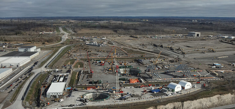
The Basement Flooding Protection Program is a billion-dollar, multi-year program to help reduce the risk of future flooding by making improvements to the city’s sewer system and overland drainage routes. It was rolled out in phases. Currently, the project is in Phase III, and there is a RFP out to complete Phase IV.
The upgrades to the sewers are happening in mature, built-up areas, meaning that they not only have potential impacts on the existing sewers but also on all other buried and aerial utilities within the project area.

To manage the risks associated with the existing utility infrastructure in the areas, the city and their design consultant for Phase I and II—CH2M HILL—implemented the use of subsurface utility engineering (SUE) processes to capture accurate reliable utility information. “The accurate utility information associated with the T2 Utility Engineers, SUE investigation has been essential to our design process to develop precise design drawings that minimize unforeseen conflict encountered during construction,” CH2M HILL program manager Rayna Volden said.
There are several risks that were mitigated by following the SUE mapping process:
- Risk to Construction Schedule: By accurately identifying the location of the existing underground infrastructure, that information is used in the design and will eliminate “surprises” that happen during construction, which would affect the overall construction schedule.
- Risk to Design Schedule: By providing designers with accurate utility information up front and early in the design process, it eliminates the need for rework and redesign caused by unknown changes based on what is found in the field.
- Risk to Budget: Project change orders due to unanticipated utilities in the field can be a major cost to the project. By providing accurate information, it reduced, or eliminated, those change orders on the project. By showing the contractor up front that SUE work was being completed, it allowed them to factor that into their pricing, knowing that they would be able to avoid delays and cost overruns in the field.
- Safety Risk: Any construction project has inherent safety risk. By providing the accurate utility information up front, the design was completed to minimize those risks. In the field, the contractor had accurate drawing to work from which also allowed them to understand the safety risks and plan for those up front.
The SUE sub-consultant on the project, T2 Utility Engineers (T2ue), followed the guidelines in the city’s RFP for completion of the SUE mapping investigation.
The SUE mapping investigations were done in accordance with ASCE 38-02 – Standard Guidelines for the Collection and Depiction of Existing Subsurface Utility Data. The purpose of the investigation was to provide CH2M HILL with accurate maps of surface features and the existing underground utilities in order to aid in the design of the new sewer systems. “Basement Flooding 1 and 2 included over 100 different investigation areas, where full topographic surveys were completed along with confirming the horizontal alignment of existing utilities, collecting invert data and installing test holes to obtain the precise horizontal and vertical alignment of utilities in conflict,” T2ue project manager Matthew Bourgeois said.
The basic process used for the investigation was the following:
- Complete review of all utility records information from the City of Toronto and utility owners.
- Obtain the required City of Toronto permit and conforming to traffic safety requirements.
- Utilize geophysical utility locating techniques to determine the true horizontal position of conductive utilities within the project area. Tools utilized were single frequency and multi-frequency electromagnetic cable locating equipment, ground penetrating radar and other methods.
- Collect invert and top of pipe information, including pipe size and pipe material, for the sewer and water chambers.
- Collect all data using survey equipment and compile a utility drawing as per ASCE 38-02 showing the horizontal location of the underground utilities at the described quality level over the project area.
- Install test holes at critical locations identified through consultation with the design team.
- Produce a final set of drawings and report for each project segment.
Using a qualified SUE consultant who followed the ASCE 38-02 standard for collecting and depicting the underground utility infrastructure in the area had huge benefits to the design, and construction stages of the Toronto Basement Flooding Program. It allowed the designers to confidently progress with their designs knowing that the information was accurate and that the contractor would be able to construct the new sewers as per the design. It eliminated redesign cost due to inaccurate information, and helped contractors reduce pricing knowing that the risk associated with utilities was being managed by following the SUE process. SUE proved to be an excellent risk mitigation strategy for the Toronto Basement Flooding Program, which should also be followed on other mega (and non-mega) projects.
Lawrence Arcand is president of T2 Utility Engineers. Ophir Wainer is the business development manager of T2 Utility Engineers.